Virginia Tech researchers explore alternative options for global navigation satellite systems

Day to day, most of us take for granted the systems powering the navigation features of the cell phones in our hands, the GPS units in our vehicles, and the smartwatches and fitness trackers that we strap onto our wrists. We rely on such devices to bring convenience to our lives, but rarely think about the science behind them or the framework of satellite systems operating high above the Earth’s atmosphere that make these tools possible.
Virginia Tech professor Mark Psiaki is rethinking the way in which we approach global navigation in the future, with the advent of large low Earth orbit (LEO) constellations.
“The emergence of large low Earth orbit constellations has the potential to be a game changer for navigation,” said Psiaki, the Kevin Crofton Faculty Chair in Aerospace and Ocean Engineering. “Through recent analysis and simulations, our results indicate the possibility of navigation performance similar to that of current global navigation satellite systems while using a simpler Doppler-based technique rather than the current pseudorange-based technique.”
In simple terms, modern global positioning systems consist of navigation satellites circling the globe that are constantly emitting signals. A GPS receiver listens for these signals and calculates its distance from the satellites using complex algorithms, enabling the device in your hand or vehicle to determine your precise location.
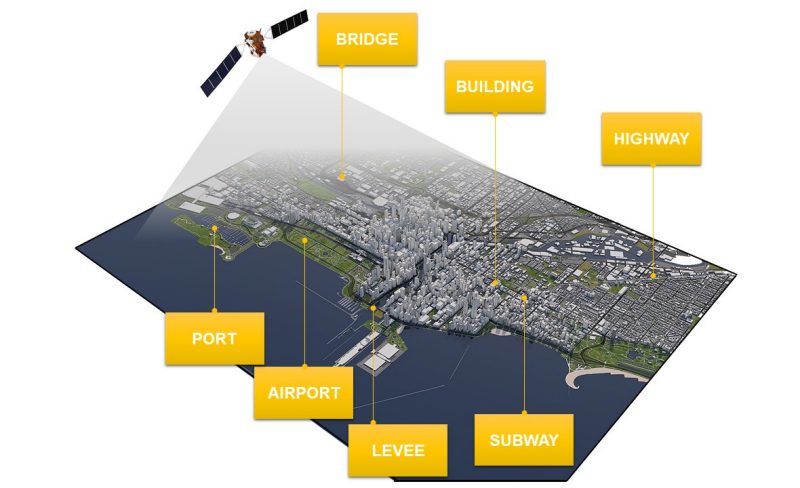
The current GPS constellation includes 31 satellites – 24 is the minimum amount — with each traveling in a 12-hour, circular orbit, 20,200 kilometers above the Earth. The satellites are positioned so that six or more are observable nearly 100 percent of the time from any point on the planet. In order to pinpoint its own precise location, a navigation receiver will determine the ranges of visible satellites as well as their positions at time of signal transmission.
The raw measurement is known as pseudorange — the distance between a satellite and a receiver plus effects of transmitter and receiver clock errors and delays in the atmosphere. Pseudorange calculations require the signals of four or more satellites to compute the receiver's location and account for clock errors.
Psiaki sees potential in an alternative approach: using large low Earth orbit constellations and Doppler-shift measurements rather than the pseudorange measurements currently employed.
Advantages in low Earth orbit with Doppler-based navigation
Doppler-based navigation has been around since the Transit program’s start in the 1950s, which was used by the U.S. Navy to provide accurate location information to ballistic missile submarines and surface ships. That system gave updates only every hour or so and required independent altitude and velocity knowledge in order to compensate for the fact that a user could see, at most, one satellite at any given time.
In order to bring Doppler-based navigation into the 21st century, it is necessary to see eight or more satellites simultaneously, and the satellites must move rapidly relative to the user. The new large low Earth orbit constellations meet these requirements.
Psiaki sees several benefits to the use of carrier Doppler shift measurements from low Earth orbit satellites over the use of pseudorange measurements from higher satellites. “Doppler shift navigation is less sensitive to transmitter clock errors, which would eliminate the need for atomic clocks on board,” he explained. “The system could work with good quartz oscillators on the satellites and without GPS disciplining. Second, Doppler shift navigation does not require the satellites to broadcast precise ranging codes. The only signal requirements are that modulated data can be wiped off by the receiver to allow measurement of Doppler shift, and that the receiver be able to distinguish signals from different satellites.”
Psiaki and aerospace engineering doctoral candidate Brian McLemore recently published this idea and an in-depth analysis as the cover story of the November/December issue of the global navigation satellite systems trade publication, “Inside GNSS.” A conference paper on the topic had already appeared, and a journal version is being revised after receiving positive reviews.
For Psiaki, the planning and launch of large constellations from companies that include OneWeb, Starlink, and Kuiper Systems, sparked the new idea for global navigation. These constellation designs consist of nearly a thousand to several thousand low Earth orbit satellites. Although each satellite is visible to a smaller portion of the Earth than those of our current navigation systems, there are enough of them to make up for the per-satellite coverage loss.
Psiaki and McLemore are not the only researchers currently exploring alternative options for global navigation systems of the future, nor are they the first to consider systems based on low Earth orbit constellations. They are the first, however, to show that full three-dimensional navigation can be achieved using only Doppler shift measurements.

According to Psiaki, the Doppler shift navigation's benefits give this concept the potential to operate with hardly any modifications to the planned large constellations. This is important because the new constellations have been designed as communication systems, not as navigation systems, which makes any need for modifications problematic.
“Another advantage is the nearness of the satellites to the users, which would enable higher received power levels that would reduce the potential impact of intentional and unintentional interference. Finally, due to the relatively inexpensive nature of the individual satellites that comprise each constellation, replacement and upgrading of satellites could happen over a shorter average cycle, which would make the concept more adaptable.”
Challenges ahead
Using Doppler shift navigation has its own challenges, as position estimation based on Doppler shift is unable to estimate it independently of velocity. In fact, one must estimate eight unknown quantities simultaneously: three components of position, three components of velocity, and the receiver’s clock offset and clock offset rate. This requires the measurement of carrier Doppler shift from a minimum of eight satellites, just as pseudorange-based navigation requires the measurement of pseudorange from four or more satellites.
Psiaki and McLemore believe that the most important contribution of their work is the development of a new version of an existing navigation concept: Geometric Dilution of Precision (GDOP). In its original form, geometric dilution of precision characterized how satellite geometry impacted user position accuracy. Geometric dilution of precision considerations dictated the need for 24 satellites in the nominal GPS constellation and their distribution of orbital properties. The generalization of geometric dilution of precision to Doppler-based navigation required a paradigm shift in order to demonstrate that satellite geometry and its time evolution both impact the accuracy of this new navigation concept.
An approach such as this would have been impossible in the past, as previous low Earth orbit constellations could not guarantee simultaneous visibility of eight or more satellites. With the planning and initial launches of several independent large low Earth orbit constellations in recent years, it is entirely possible that smartphones in the future will be navigating via this concept, according to Psiaki. Through analysis of geometric dilution of precision and through simulations, his results point to achieving navigation performance similar to that of current pseudorange-based global navigation systems.
—Written by Jama Green